

The Wild Atlantic Way -Sligo & Mayo Part 1
- Aug 19, 2025
- 9 min read
Well, I don’t know why we were worrying that Donegal had set the bar too high – Co Sligo and Co Mayo have continued to dish up stunning site after site.
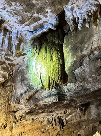
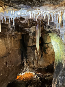
Our brief foray into Northern Ireland took us to the Marble Arch Caves in Co Fermanagh. These are a network of caves, sinkholes and underground rivers that were formed over 340 million years ago. We booked on a guided tour (the only way to visit) which takes you on a short boat ride into the caves, then we walked about 1 1/2km of the limestone cave system looking at various features along the way. Did you know it takes 100 years for a stalactite to grow just one mm?


We had spotted a car park down the road from the caves that allowed overnight motorhome parking for £10. From here people were doing the Cuilagh Boardwalk Walking Trail (also known as the Stairway to Heaven) which leads up to a panoramic view of the area. It takes 3-4 hours return, so we decided it was too late for that evening and we enjoyed a scenic spot, if not a bit windy, for the night.


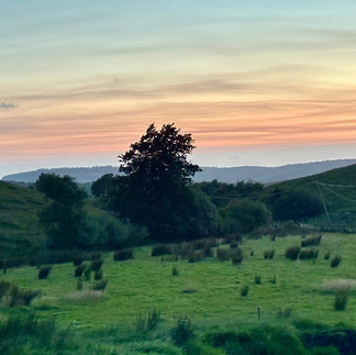


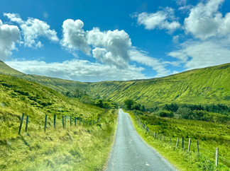
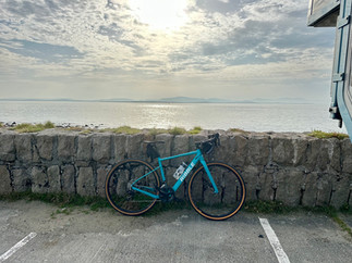
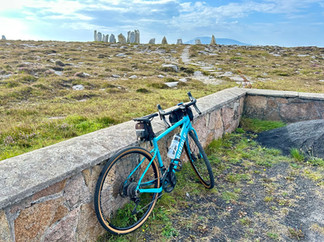
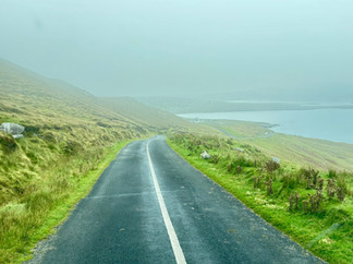
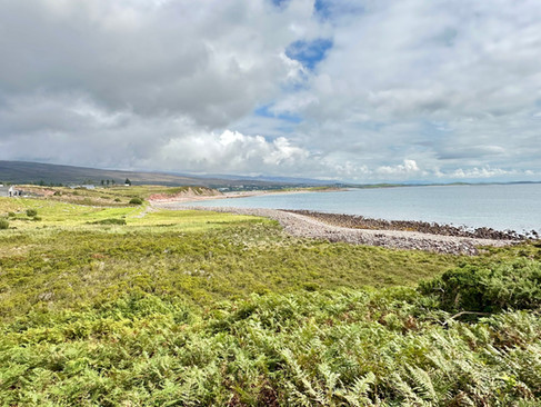
In the morning we decided to skip the walk and instead head back nearer the coast to cycle the Gleniff Horseshoe Loop. It is just a 10km route on a largely singletrack road with beautiful dramatic mountain scenery. We cycled around clockwise and were so enamoured with it we cycled back round the other way.


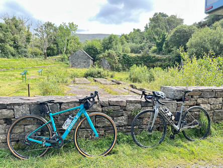
We then drove it in Lo11y for good measure.


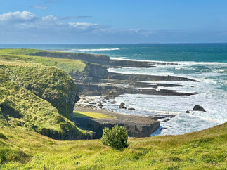
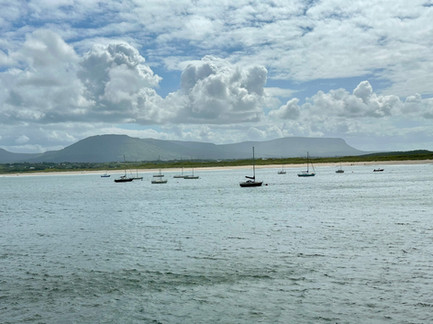
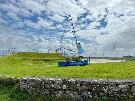
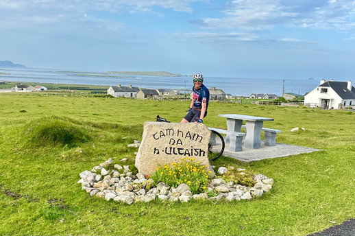
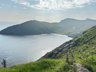
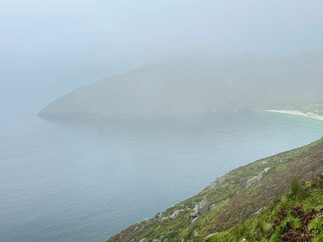
From here we rejoined the WAW route on the northern edge of Sligo at the Mullaghmore peninsular. There is a 5km loop around the peninsular that had a one-way system for the summer months. The views are just spectacular with a private castle as a backdrop near the start of the drive.


We parked up in Mullaghmore Village which has a lovely harbour area and green (with grazing rabbits). The sun was out so we enjoyed a spot of lunch soaking up the view. We had a stroll around the harbour where an artist was showing amazing photos of humpback whales in the bay. She said a pod of orcas was around in the peninsular at the moment too.


Our next Discovery Point was Streedagh Point. The WAW has 180 Discovery Points which are marked with distinctive metal signs and will be a site with a special view, of historical significance or of cultural significance. There are also 15 Signature Points which are deemed to have exceptional characteristics (Mullaghmore Head being one of them).
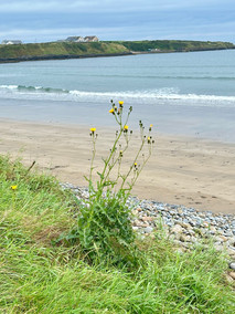
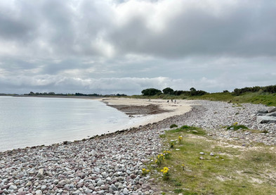
As well as being a stunning 3km beach, Streedagh Beach is known for having three offshore Spanish Armada shipwrecks and species of fossil coral formed over 400 million years ago in the limestone cliffs.


We had tried booking into a couple of campsites but, being the weekend, they were fully booked, so we headed to a little out of the way place called Raghly Harbour which has spots where 4 or 5 motorhomes could park up. It was idyllic – beautiful views in all directions and a 3km way-marked walking trail around the headland. We even saw seals just outside the harbour.


The following morning we cycled to another Discovery Point – Rosses Point which has a big sweeping beach and was much more of a tourist hub with a big campsite and many eateries. We were glad we hadn’t been able to get into the campsite. This area if also famous for the poet WB Yeats and his artist brother Jack. I had to explain to Colin these were not the same brothers from Manchester who cycle in the Tour de France.


Back in Lo11y we carried on the WAW passing Sligo which reads as being a nice town with a good food scene, and the very touristy resort of Strandhill. It was so busy we couldn’t get parked up and the main car park had a height restrictor on – the first we’ve come across so far.

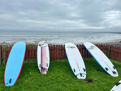
We continued on to a little seaside village called Aughris which has a pub with a small campsite which sounded like a perfect spot for a Sunday evening. It looked very busy when we arrived, so we were half expecting to be turned away, so we were delighted when they said park up where we like – we got a perfect frontline spot. There was a surf school based there. We had some hearty pub grub that evening and hunkered down for a very wet night.


The following day we had a number of Discovery Points to visit along the Sligo and Mayo coastline.


The first stop was at Easkey whose pier has an old castle (Roslee Castle) sitting on it making it an impressive sight. The surrounding bays were busy with surfers.


Next was Inishcrone, a popular beach resort with another scenic pier. We had read about the Kilcullens seaweed baths here. We are keen to try a seaweed bath that is said to be good for the skin and have healing properties (although Colin is convinced this is just old blarney) and these baths are very traditional rather than being like a modern spa. We hadn’t booked as we weren’t sure what time we’d be passing through, and sadly the risk didn’t pay off as they had no spaces until late afternoon.


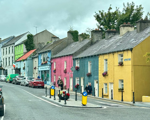
We now crossed into Co Mayo, through the colourful town of Ballina, with a quick stop at the Quay in the fishing village of Killala. There was a big round tower in the village centre dating back to 12th century when the village was an important ecclesiastical centre.


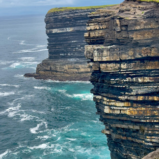
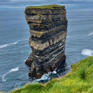
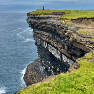
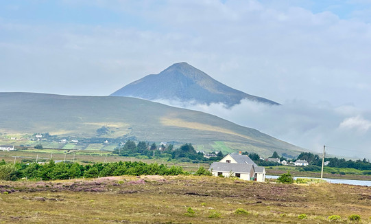
Our next stop was at a Signature site – Downpatrick Head. It is set in a breathtaking position with windswept cliffs and battered by the Atlantic Ocean. The centre piece is the stunning Dun Briste sea stack (45m high, 63m long and 23m wide). Also on the headland there is the ruins of a church, a stone lookout post used during WW2 and a blow hole. All a big wow factor.


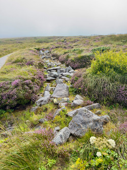
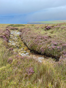
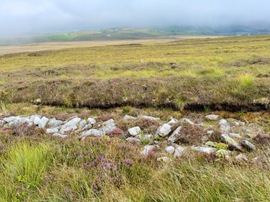
Not far from here is the Ceide Fields visitors centre which showcases the oldest known stone-walled field systems in the world – dating back over 6,000 years. The megalithic tombs and dwellings were all submerged under the Atlantic bogland and weren’t discovered until the 1930’s when a farmer was cutting peat. The visitors centre is really well set up, going through the history of the people who had originally settled in this area and the importance of bogland and peat for climate change. The peatland bog in Mayo provides a unique habitat for plants and wildlife and the bog which is created by thousands of years of decaying plants traps carbon which is a vital part of controlling climate change. On the slopes of Ceide Hill, peat bog can take 1,000 years to grow just 30 cms. In its natural state peat bog traps the carbon underground. The large scale cutting and burning of turf releases large quantities of carbon into the atmosphere which is why Ireland is rewetting its bogs so they become carbon storing again. However, as peat is still a much used form of heating for the Irish we wonder if it will be achievable to get the balance required to really make a difference. A self-guided trail outside the visitor centre provides stunning views across the bogland and ocean.


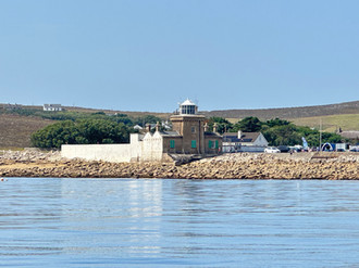
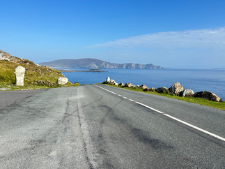
We drove on to the Belmullet peninsular – just 25km long - but once past the main town of Belmullet (which was closed off for their annual festival) the landscape gets wilder with some lovely unspoilt beaches. We parked Lo11y up at the far end of the peninsular next to the Backsod Lighthouse. It was a lovely warm sunny evening, and we watched boats coming in and out of the harbour and enjoyed a nice sunset. There were adverts for sea safaris from here, and we managed to get ourselves booked on one the following morning.


The boat trip wasn’t until 11am, so we did a short loop of the south of the peninsular on our bikes beforehand. The scenery was just stunning with views across to Achill Island where we were heading later in the day.


The weather was perfect for the boat trip. The website had said we’d have an exhilarating two hours on a rib boat and would be looking out for seals, dolphins, otter, minke whales and possibly basking sharks. We were a bit bemused to be directed to an old (smelly) fishing boat with a family of four. We were late setting off as we were told there were 6 more due to join us, so we were quite relieved when they were a no-show. Pat, our skipper, was a pleasant chap but wasn’t the font of all knowledge on sea life (or anything for that matter) that the website promised. We were taken to a small resident colony of seals and Colin spotted an elusive black rabbit that inhabits one of the islands. We sailed past some uninhabited islands with derelict buildings on. One had been a former whaling station. We thought that was to be our lot, but on our way back a group of dolphins sped past and around us for a few minutes.


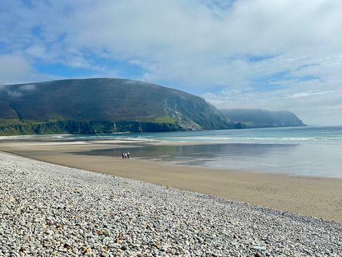
After leaving Belmullet, we drove around the peninsular to Achill Island, which is Ireland's largest island and is joined to the mainland by a bridge. We made our way across the island to Keel beach – 3.5km of loveliness. It was absolutely thronging with visitors, both Irish holiday makers and overseas tourists. The large campsite in the village looked a bit scary and overcrowded, so we found a quiet spot further down the beach. We didn’t have a direct sea view, but it was sheltered, level and quiet. It was a beautiful late afternoon, so we got the bikes out and cycled the 9km to Keem beach on the western edge of the island. To reach it we had to cycle up a long steep narrow road – it was a hill that kept on giving so we didn’t really notice the stunning vistas from it. Keem beach came into view - a stunning horseshoe shaped beach surrounded by towering cliffs. Strangely we both decided that cycling down a long windy hill to the beach (that would require cycling back up) wouldn’t provide us with better views, so we enjoyed the largely downhill return to Keel. We stopped for a drink in a pub just before the beach and enjoyed a peaceful night.


The following morning we got on the bikes to cycle a loop along the north of the island, then on to a loop around the south. The coast was very misty with low lying cloud but the scenery was stunning. We couldn't believe the contrast to the touristy Keel beach - we explored quiet bays and admired the colourful hedgerows and lovely properties tucked away. We joined the main road that would take us to the southern part of the island, but the low lying cloud looked worse in the direction we were heading, and as this loop was all about dramatic ocean views and cliffs we decided there was little point cycling it without the views so we retraced our steps along the north with a few deviations. We stopped for brunch at a nice cafe in the village of Dugort.


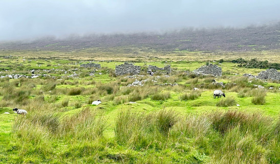
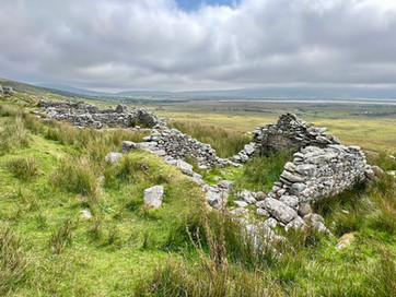
On the way back to Keel beach we called in at the Deserted Village site. Once there was a settlement of around 100 houses on the hillside, but the residents had all moved away since the famine either being evicted, emigrated or moved nearer the sea to have easier access to seafood and shellfish.


Back at Keel beach the sun finally burnt through the mist so we got our bathers on and walked down the vast beach with purpose to join the locals for a dip in the sea. It wasn't the warmest experience and Colin is still going on at me for not actually swimming - a few waves crashing over me was enough thank you very much.
We had picked up some local lamb burgers for tea, so we finally had a barbecue and enjoyed some evening sunshine.


The following morning we were going to visit the south of the island to see what we'd missed the day before. First we drove back to Keem Beach to see it in the morning light and get a bit further down the road for a closer look. Motorhomes have to park half way down the hill due to a height restrictor on the lower car park. It is a very beautiful bay. As we drove away it was completely shrouded in mist - it's amazing how quickly it changes.


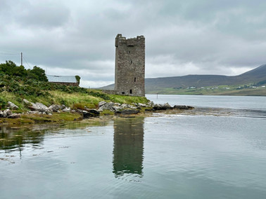
The southern island route was very scenic - it would have been a lovely cycle route. The main sites were the White Cliffs of Ashleam and the Grace O'Malley Tower House - she was a Pirate Queen in the 16th century who's name seems to crop at many of the sites on this coastline.


As we leave the lovely Achill Island and continue exploring Mayo, I think it's time to give you a breather before the next instalment.


Comments